


SEJournal Online is the digital news magazine of the Society of Environmental Journalists. Learn more about SEJournal Online, including submission, subscription and advertising information.
September 20, 2023
 |
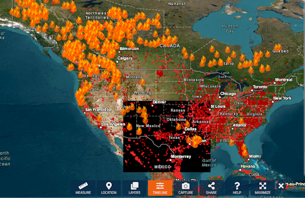 |
| A wildfire map available through the National Interagency Fire Center, which presents much of its data in a graphic, map-based format. Image: NASA/Fire Information for Resource Management System. |
Reporter’s Toolbox: Top Data Sources Can Help Cover the Larger Wildfire Story
By Joseph A. Davis
Wildfires are bad news. But after the flames are out and the devastation is faced, a big part of the story is about how big the fire was and how wildfire is worsening.
The “good news” (if there is any) is that the abundance of wildfire data available to environmental journalists can help tell that story. Not only is there plenty of it but there are many kinds to look at. So instead of giving you a single database, this Toolbox aims to survey a broad range of sources that can add perspective.
Most of the data from the sources mentioned below is of good quality. But as always with data journalism projects, it is important to ground-truth the data you use and to do the shoe-leather and phone reporting that sets it in context.
Here’s our list of eight top wildfire resources:
-
National Interagency Fire Center: The NIFC, headquartered in Boise, Idaho, is a collaboration of federal and state agencies engaged in monitoring and fighting wildfires. Major players include the Bureau of Indian Affairs, Bureau of Land Management, U.S. Fire Administration, U.S. Fish and Wildlife Service, U.S. Forest Service, National Association of State Foresters, National Weather Service and National Park Service.
Because the NIFC is virtually at the eye of the storm, it is a great place to find summary data in nearly real time. It is especially good at compiling and presenting overview pictures in statistics. And — fortunately for news media — it is geared toward daily reports on individual incidents, as well as the overview. At the height of the season, it is tracking hundreds of fires.
And because wildfires are inherently geographic, the NIFC helps journalists by presenting much of its data in a graphic, map-based format. To work with this, you need some familiarity with geographic information system formats, or GIS. It is a can of worms for those not familiar with GIS data. Many people start by getting a copy of (hopefully free) ArcView software from the Esri company. Some consider it legacy software and there is much more to learn.
You can get some idea of the range of NIFC data products here. Once you know what you want, a good starting access point to data products is here.
-
InciWeb: InciWeb is a federal multiagency collaboration that presents many kinds of data — not just about wildfires but about other incidents. Still, it is mostly about fire incidents and much of the data presented originates with NIFC. InciWeb’s organizational matrix is called the National Wildfire Coordinating Group.
-
National Centers for Environmental Information: The NCEI is a part of the National Oceanic and Atmospheric Administration, whose purpose is to compile and disseminate all kinds of data — most typically weather and climate data. A good starting point for NCEI’s fire data is here. Most of it comes from the NIFC.
-
Federal Emergency Management Agency: What federal agency got to the site of Mauna Loa’s fire disaster first? It was probably FEMA. You can begin to find FEMA wildfire data here, including its Wildfire Risk Index.
-
National Integrated Drought Information System: The NIDIS is another federal/state/NGO information consortium focused primarily on drought conditions. Its approach is interagency, and journalists like it because it offers not only regular updates of current conditions but also predictions of drought conditions to come.
-
U.S. Environmental Protection Agency: The EPA has a number of interests in U.S. wildfires. Today, with the growing incidence of wildfires, one of the EPA’s biggest concerns is the public health effects of the widespread smoke pollution that comes from wildfires. But the other key issue for the EPA is that wildfires are a manifestation of climate heating.
-
National Aeronautics and Space Administration: NASA is the agency that flies the satellites (although many of the satellites are built and operated by other agencies). Satellites, of course, have a very good vantage point (and very sophisticated instruments) when it comes to observing wildfires. This data is everywhere — and global in scope. One place to find NASA wildfire data is its Fire Information for Resource Management System, or FIRMS. Another way to get there is NASA’s Earth Science Data Systems portal, aka Earthdata.
-
U.S. Geological Survey: The USGS is a relatively nonpolitical, reliable science agency, and one of the main agencies for all manner of Earth sciences. With the U.S. Forest Service, the USGS operates the Fire Danger Forecasting Project. You can find more about USGS wildfire research, and resultant data, here.
[Editor’s Note: For more, be sure to visit our “Topic on the Beat: Wildfire” resource, which has nearly a dozen and a half stories from the pages of SEJournal, plus links to the latest wildfire headlines with EJToday.]
Joseph A. Davis is a freelance writer/editor in Washington, D.C. who has been writing about the environment since 1976. He writes SEJournal Online's TipSheet, Reporter's Toolbox and Issue Backgrounder, and curates SEJ's weekday news headlines service EJToday and @EJTodayNews. Davis also directs SEJ's Freedom of Information Project and writes the WatchDog opinion column.
* From the weekly news magazine SEJournal Online, Vol. 8, No. 33. Content from each new issue of SEJournal Online is available to the public via the SEJournal Online main page. Subscribe to the e-newsletter here. And see past issues of the SEJournal archived here.
SEJ Publication Types:
Topics on the Beat:
Region:
Visibility: